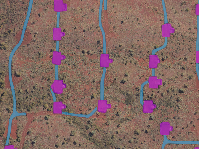
Delivering Land Disturbance Reporting To Regulators
It’s The Outbox That Counts – Delivering Land Disturbance Reporting To Regulators Outline’s ADM, AI-assisted technology including object detection, segmentation…
It’s The Outbox That Counts – Delivering Land Disturbance Reporting To Regulators Outline’s ADM, AI-assisted technology including object detection, segmentation…
Spatial Insights By Outline Global For The Global Resources Innovation Expo – GRX25 The best way to predict the future…

About the Malleefowl Governments place stringent conservation requirements on industries that traditionally disrupt the habitat of protected species. One of…

Over the years, Outline Global has tackled diverse coastal monitoring challenges by combining our high-resolution aerial imagery, LiDAR technology, and…

As the mining industry continues to evolve, its commitment to environmental stewardship and sustainable practices has never been more crucial….

At Outline Global, we live by the motto: “Wherever you need us, whenever you need us.” Our recent night LiDAR…

When we think of urban heating, we usually think of trees. We all know that trees contribute significantly to the…

The recent floods in North Queensland and Cyclone Zelia have highlighted the mining sector’s critical need for rapid, high-resolution flood…